Day 2, Tillamook, OR

Welcome to another hot and sunny day (Sunday, 14 Sept) in Tillamook, Oregon.  Today we wanted to get out and see the Air Museum and the local cheese factory… and we did!  Follow along on our fun-filled day with lots of pictures 🙂

Stilla did the Skype thing to Germany with her brother and sister-in-law, Stefan & Annerose while I finished up the previous days blog post and had breakfast.  We got a late start, but finally got on the road around 11 AM.  We set the thermostat for 72 degrees and left the air conditioners on for little Coach since we knew he wouldn’t be allowed into any of our proposed destinations for the day.

IMG_3383
Our site on Sunday morning at the Tillamook RV Park

Our first stop was the Tillamook Air Museum.  We had stopped by there yesterday to check on rates, hours, and dog-friendliness so you may remember these next two pictures I posted already.

IMG_3271
Signage for the Air Museum at the corner of Hwy 101 and Long Prairie Rd.

Here’s the giant hangar as viewed from Hwy 101 aka The Pacific Coast Highway.

IMG_3273


IMG_3294

My friend Wikipedia provides more information on the museum.  If you are as interested as I am about this stuff, go to this Link: http://en.wikipedia.org/wiki/Tillamook_Air_Museum

The Air Museum also has it’s own website which is a great source for specific aircraft information: http://www.tillamookair.com/aircraft/  Go ahead, click on the link… don’t be afraid.

Here is the hangar door as viewed from the inside.

IMG_3280

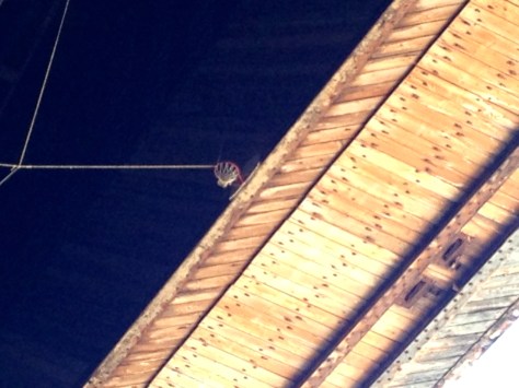
I noticed this basketball hoop mounted above the hangar door.  Someone had a good sense of humor, it’s probably 200 feet from the ground.  I’d like to see the person that could make that jump shot.

IMG_3279

Interior view of the massive hangar.

IMG_3282

The museum offered a discount for military and veterans, so we got in for $7 each.  We went into their theater and viewed the 16 minute video on the history of this unique structure.  After watching the film, we spent a long time in the adjoining room that was loaded with dioramas, models, picture boards, and display cases of historical stuff that was related to the hangar and/or WWII.  Sorry, no pictures here… I had to limit the size of today’s post somehow, right?

Here is a picture of a picture depicting what it looked like back in the day when the blimps were inside.

IMG_3342

Although you can’t tell from this picture… This was a HUGE billboard mounted on an inside wall of the hangar depicting the varied sizes of blimps.  This hangar was originally built for the K-Class.

IMG_3290

There were originally two of these hangars here.  We learned that the other hangar was destroyed in a spectacular fire.  It was being used to store hay from the adjacent farms at the time.

The following pictures are of some of the aircraft we viewed:

IMG_3292

IMG_3313

IMG_3286

IMG_3285

IMG_3284

IMG_3296

IMG_3297

IMG_3298

IMG_3299

IMG_3301

IMG_3300

IMG_3303

We met up again with our neighbor’s from the RV Park… Orman and Susie Claxton!  I mentioned in an earlier post, that we know them from the Alpine Coach Association Group and recent Redmond FMCA Rally that we attended together.  We noticed their coach, a Beaver, when we first pulled into the park so we made sure to park next to them.  We kept bumping into them throughout the day… not a bad thing.

IMG_3314

One interesting tidbit we discovered while walking through the museum hangar, is that they have RV’s stored here in the back half.  I figured it must be a way to increase their income.  Wouldn’t it be cool if they let you camp there with hook-ups?

IMG_3293

We then walked outside to view the funny looking plane… it was like the proverbial elephant in the room.  Behold a Mini-Guppy.

IMG_3281

IMG_3316

IMG_3320

IMG_3324

IMG_3321

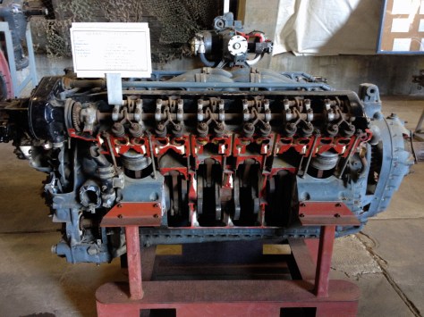
For you mechanical techno-geeks out there, they had some cool engine displays… some of them cut-outs.  These were really cool.

IMG_3306

IMG_3307

IMG_3308

IMG_3310

How about an old V8?  Neat, huh?

IMG_3311

Here’s proof that you can put anything on a trailer these days.

IMG_3312

We visited the snack bar for an espresso.

IMG_3288

IMG_3287

IMG_3336

And then wandered through the gift shop.  Didn’t find anything I couldn’t live without.

IMG_3337

IMG_3332

Neat picture of a picture again… this guy flew through the hangar back in 1950 as part of an air show stunt.

IMG_3333


After we got our fill of all things aviation related – we headed over to the Tillamook Cheese Factory on the other side of town.  It was certainly a popular place as evidenced by the overflowing parking lot.  There were even a few rows of Motorhomes parked on the outside edges.

IMG_3363

IMG_3364

I just had to join others in getting my picture taken in the VW bus that was part of the lobby display.

IMG_3356

View of the inner workings at the cheese factory… pics didn’t take so well through the glass panes.  I remember thinking it’s a good thing we weren’t looking at a sausage factory 🙂

IMG_3343

IMG_3344

The upstairs hallway with the factory viewing windows on both sides.

IMG_3345

There was a long line at the cheese sampling stations.

IMG_3338

As a matter of fact, there were long lines everywhere here, in the lobby store, the cafe, the snack bar, the ice cream counter, etc.,  What a popular tourist trap, er, I mean, attraction.

IMG_3340

IMG_3348

IMG_3349

IMG_3350

IMG_3351

IMG_3352

IMG_3354

I bought one of these Oregon Coast 101 stickers to add to my collection on the inside of the basement doors of the Urban Escape Vehicle.

IMG_3355

We saw Orman & Susie Claxton again with ice-cream in hand while we were here, but no picture this time.

IMG_3358

IMG_3359

And I almost bought this T-shirt, but decided it wasn’t in the budget.

IMG_3361

Next, we drove back into town to check out the Blue Heron Cheese Company.  We had seen an advertisement for free wine and cheese tasting.

IMG_3370

IMG_3369

There were a couple of cool vehicles on display outside the building.

IMG_3365

IMG_3366

We met up with Orman & Susie again!  We sampled some wines together and  ended up buying a bottle called “Blue Heron Riesling”.

IMG_3368

We got back to the RV Park with plenty of time left to enjoy the sunshine and walk Coach through the campground.  He was VERY happy to see us again after being cooped up all alone for the day 🙁  Everything was fine with him and there were no “surprises” in the Motorhome.  Good dog.

IMG_3379
View of the lower picnic grounds area at the Tillamook Elks RV Park.
IMG_3377
View of the BBQ grill shelter in the lower picnic area at the Tillamook Elks RV Park.
IMG_3376
View of the lower picnic grounds at the Tillamook Elks RV Park.

This park has the biggest set of horseshoe pits I’ve ever seen.  Or are these possibly grave sites?  HMMM.

IMG_3371
View of the horseshoe pits on the lower picnic grounds at the Tillamook Elks RV Park.
IMG_3380
View between the two rows of RVs at the Tillamook Elks RV Park.
IMG_3382
View of the community multi-use house at the Tillamook Elks RV Park.

We spent a little time talking to Orman & Susie as the sun went down.  We got a few tips from them on future places to visit and recommendations on RV Parks.  Thanks Orman & Susie!  Hope to see you down the road again soon.  It got cold pretty quick after the sun went down, so we retired to our respective Coaches to call it a night.

I did some research, and called ahead to the Elks Lodge in Florence, OR to reserve a spot for tomorrow.  So another moving day is on tap for Monday.  See you tomorrow.

Day 1, Tillamook, OR

Another hot, sunny day here on Saturday (13 Sept) in Tillamook, OR.  We’ve been told that this nice weather is highly unusual for this time of year.  We decided to get out and enjoy it for most of the day.

But first, here’s a morning picture of our RV site at the Elks RV Park. It’s nice having full hook-ups and a good internet connection for a change.  We have WiFi through the park and also have good AT&T 4G signal on the iPhones.  We haven’t even turned on the MiFi JetPack with Verizon.

IMG_3196

The RV Park hostess provided a map yesterday at check-in that was chock full of tourist attractions and activities, so with map in hand, we headed out for another day-trip.

We decided to take a loop (tip was courtesy of our neighbor Susie Claxton) by going South from the RV Park which is just off Hwy 101 and then turning West to skirt along the coast going North again on Three Capes Road.  We left the park at 10 AM.  Shortly after driving South, we saw a sign for Munson Creek Falls to the East.  We decided to check it out… you can never get enough falls, right?  It was only 1-1/2 miles off our intended route on a mostly bumpy dirt road.  Once in the turn-around parking lot, we saw that it was a 1/4 mile hike.  We felt up to that.

IMG_3197

IMG_3202

The trail was nice and reminded us of being back in the Hoh Rainforest again.  We were the first people there, but it was short-lived.  As soon as we got on the trail we saw about 4 other vehicles pull into the parking area too.

The trail was closed just a little ways before the bottom of the falls.  This is as close as we could get (pic below).  We said, “Ooh, Aah”, took a picture, and headed back.  We passed the many other folks along the trail that were coming in while stopping to answer the common question: “What kind of dog is that?”

IMG_3204

After the falls, we got back on Hwy 101 for a short distance before turning West as planned.  We skirted the coast on the unusually wavy and bumpy road in dire need of repair.  We passed the seemingly popular Whiskey Creek Fish Hatchery, there were absolutely no parking spots left, even the sides of the road were full of cars, so we drove on.

We kept our eyes open for a place to stop and eat breakfast, but found nothing.  We didn’t eat before we left this morning 🙁

We stopped at this nice beach that was being enjoyed by lots of folks out for the weekend.  There were signs posted that said not to approach the sea lions, but we didn’t see any.

IMG_3209

IMG_3212

IMG_3213

IMG_3215

IMG_3214

We then drove to Cape Meares.  It turns out the road past this point was closed, so we would have to double back a ways to get to Tillamook… still no sign of a restaurant or cafe to get breakfast at.

But, here’s a sign that describes Cape Meares:

IMG_3217

And a highly ornate informational kiosk in the parking area for the Cape Meares Lighthouse.

IMG_3219

IMG_3216

We walked down to the lighthouse and took pictures of the scenery along the way.

IMG_3223

Here I tried to zoom in on some sea lions or other such related critters that were hanging out on the rocky coastline below.

IMG_3228

View from near the lighthouse.

IMG_3232

IMG_3233

IMG_3221

IMG_3235

We took turns taking the free tour through the lighthouse.  They didn’t allow dogs.

IMG_3242


I took some pictures inside the lighthouse:

IMG_3260

IMG_3257


The floor above that surrounds the light had glass inserts in the floor.

IMG_3259

IMG_3256

View from inside the lighthouse at the top.

IMG_3255

IMG_3252

IMG_3253

IMG_3251

IMG_3254

We took a different trail back up to the parking lot.

IMG_3244

We looked real hard… but didn’t get to see any whales,  Stilla was disappointed.

IMG_3236

IMG_3267

Back at the parking lot, there was a relatively short path that led up the hill to an Octopus Tree.  Here’s the informational placard.

IMG_3263

IMG_3264

Pretty cool in a weird kind of way.

IMG_3262

We then took the long way around to get back to Hwy 101 because of the road closure… still didn’t see a place to get breakfast!  So when we got into the town of Tillamook, we spotted a Pancake House that served breakfast all day.  We found a spot out front, put up the sun-visors, and cracked the windows for Coach while we went in and got a late breakfast finally.

After breakfast, er lunch, we debated on whether to go to the Cheese Factory or the Air Museum.  We figured the Cheese Factory definitely didn’t allow dogs, so we drove to the Air Museum to see if they were dog-friendly.  They weren’t.  But we found out they have a nice cafe just inside their doorway and it’s only a $7 entrance fee for veterans.  But it was too hot to leave Coach in the Silverado so we headed back to the RV Park with the thought we could leave Coach in the air-conditioned Motorhome.  But, I think we were both feeling tired and lethargic from the big breakfast, so we just hung out at the Park the rest of the day instead of going back.  There’s always tomorrow, right?

IMG_3271

IMG_3273

I spent time in the afternoon-evening to catch up on my blog post for the trip down here.  And here I am again this morning (Sunday) catching up on this blog post for Saturday.  Time to close this post and head out for more adventures…

C U tomorrow!

Moving Day (Tillamook, OR)

It’s time to move on again today, Friday (12 Sept).  We’ve really enjoyed this state park.  Would definitely come here again to Cape Disappointment if the opportunity arises in the future.

We met a nice couple that was camped next to us, they come here every year from Eatonville, WA.  My neighbor’s name was Brian, but I don’t think I caught his wife’s name.  Brian was interested in tips on diesel pushers and was full of questions.  He was thinking of getting a Class A in the future.  I tried to be as informative as I could without  seeming biased… hard for us Alpine Coach owners, eh?  Anyway, safe travels Brian – good luck with your search and I hope I was able to help.

IMG_2938

Before we packed up, we took another morning walk.  I noticed a little-used trail behind our camping circle, so we followed it through the woods towards the cliffs as we swatted away spider webs across the path.

IMG_1849

We ended up finding a couple of hidden caves.

IMG_1864

IMG_1846

And then, I’m convinced we found the remains of an old ship wreck hidden in the trees near the cliffs.  The remaining wood is covered with moss and pine needles… What do you think?  Stilla won’t believe me.

IMG_1868

IMG_1869

IMG_1870

We continued on the hidden path  and came out onto the beach again.

IMG_1857

Once on the beach, we came upon someone’s idea of a beach fort.  They must have spent some time on this… it even had a “garden” in the front “yard”.

IMG_1872

After our morning’s exploits, we finished packing up and then drove the Coach to the park entrance, Stilla followed in the Silverado.  We connected the truck up to the Coach once we were at a wide, straight section in the road.  We successfully navigated under all the low-hanging branches and came through unscathed again.

We headed South on Hwy 101 again after exiting the park.  Then we crossed over the Columbia River into Oregon via the Astoria-Megler Bridge that I posted about yesterday.  After going through Astoria we started looking on-line for RV Parks.  We didn’t have cell service for the last two days at Cape Disappointment on either the iPhones with AT&T or the MiFi Jetpack with Verizon so I hadn’t done any prior planning.  I quickly determined that Tillamook had an Elks Lodge so I called their number to ask if they had RV parking and it turns out that they have their own RV park just South of town that is separate from their downtown Lodge.  Wow!  Who knew?  So I called ahead to make sure they had room.  Dixie, the camp-hostess said, “Come on in!”

Our first rest stop was above Smugglers Cove after the town of Cannon Beach.  We enjoyed the views and took a couple pictures.

IMG_3155

IMG_3159

IMG_3154

And here’s the obligatory “selfie”.

IMG_3160

Here’s a few pictures of our second and final rest stop for the day.  Nice views, eh?  I think it was overlooking Devils Cauldron, also not far South of Cannon Beach.

IMG_3173

IMG_3171

IMG_3178

IMG_3181

Here’s the entrance to the Elks Park, located ~5 miles South of Tillamook.  Total travel distance for the day was just under 90 miles.

IMG_3184

View of the rigs in the Elks RV Park.

IMG_3185

As soon as we pulled in, we met the Camp Hostess, Dixie.  She rolled up in her golf cart to greet us.  She told us to pick a spot and stop by once we got settled to pay the $20 per day donation.  However, before I parked the Coach for the next couple days, I wanted to get fuel – I was on 1/4 tank.  It’s always best to keep the tank as full as possible at all times to prevent moisture from condensation building up in the tank and possibly even causing algae to grow.  This can wreak havoc on your fuel system and especially filters.  I had been on the look out for a decent fuel station the entire trip today that would accommodate the Coach while I was still towing the truck, but only saw one place back in Tillamook.  But, naturally I was already past it before I realized it would have worked for us.  I mentioned my need to get fuel to Dixie, and she recommended a place just back up the road that I must have missed.  So we disconnected the truck and parked it in the spot we wanted and headed back out to fuel up.  We found the country store / gas station alright and topped off.  Diesel was $3.99 a gallon!  Here in Oregon, a gas station attendant has to pump your fuel by state law.  The attendant said this was the first time he pumped so much into one vehicle.

IMG_3182

After returning to the RV Park and setting up.  We turned on the AC(s) so we could leave little Coach in the Coach in order to go into town and partake of the Elks Lodge Friday dinner.  One thing about Elks lodges across the country is that they all seem to offer a good meal every Friday for a good price and we heard from Dixie, that tonight’s specialty was a fish platter.  This park has full hook-ups with 50amp service, so we could leave both air conditioners on… and it was so hot, we needed it.  We also took the bicycles off the Silverado so we wouldn’t have any trouble in town finding a parking spot to fit into.  And also, as I think I’ve mentioned before, the bike rack sticks out pretty far with the tailgate down and I don’t want to get a ticket from the local police.

BTW – We chose the RV site next to Orman and Susie Claxton who we know from the Alpine SoCal Association and Redmond FMCA Rally we recently attended.  It’s a small RV world out here 🙂

Here’s a couple pics of the downtown Tillamook Elks Lodge #1437.  The food was great!  But I didn’t like the slot machines in the bar area we frequented before dinner… they didn’t give me any money! 🙂

IMG_3193

IMG_3188

For tomorrow (Saturday) we already got a lot of tips on things to do and see in the area: Munson Creek Falls; Tillamook Cheese Factory tour; Air Museum; 3 Capes; Octopus Tree; Cape Meares and Lighthouse… so stay tuned for our next adventure…


Day 2 at Cape Disappointment State Park, WA

Our first morning (Thursday, 11 Sept) at Cape Disappointment State Park promised to be yet another warm, sunny, and pleasant day.

Hopefully, we were all able to take a moment to remember the victims from the cowardly terrorist attacks of September 11, 2001.

We took a leisurely morning stroll on the beach at our new campsite.  Here is the path to the beach – the Urban Escape Vehicle is behind the clearing you can see at the end of the path.

IMG_2907

View towards the beach crossing the dunes.

IMG_2908

Low tide.

IMG_2910

Stilla with morning coffee in hand.

IMG_2911

IMG_2912

Stilla poses on the beach 😉

IMG_2929

We jumped in the Silverado a little before noon with the intent to do some more exploring today.  And exploring we did!  We started out by visiting the Waikiki Beach area of the park and the long jetty which protects the Northern end of the Columbia River outlet.  The beach was very similar to the one by our site except it seemed to be littered with a lot more giant drift-wood logs.  It was the “day-use” beach for the park and had a giant parking lot for visitors.  We just viewed it from the road, having just been on our beach earlier in the morning.  This super-long jetty was built in the early 1900’s and is called the North Jetty.   You can read more about Cape Disappointment by clicking this Wikipedia link…  http://en.wikipedia.org/wiki/Cape_Disappointment_State_Park

IMG_2939

We gave up trying to walk all the way to the end of the jetty.  It got way too rocky towards the end and we had to carry Coach over the larger rocks.

IMG_1832

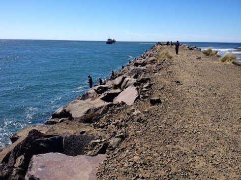
There were many people fishing from the rocks on the jetty.  This must be a  popular spot, they were lined up all along the shore.  While there, we watched at least two people haul in what looked like large salmon.  Man, I wished I could go get my little trout fishing pole that I still have bungee-corded to the truck cargo rack 🙂

IMG_2940

This view from the jetty shows “our” beach near the campground.  The North Head Lighthouse that we visited yesterday is on the cliffs overlooking the ocean to the left.

IMG_2944

Large waves broke on the rocks next to us.  It can get pretty loud.

IMG_2948

Our next stop at the top of the hill from the jetty was Fort Canby and the Lewis and Clark Interpretive Center which are combined at one location.

IMG_2953

Fort Canby was established in 1852, the state park came about in the 1950’s.  We toured inside the bunker type buildings (it was free) which housed a display of the stored ammunition for the giant guns that once were emplaced here.

IMG_2954

Amazing what the salty sea air can do to metal over time.  This giant metal door, or what’s left of it, is on one side of the bunker entranceways.  I thought it made for a good picture.

IMG_2957

This is where one of the guns used to be emplaced.  They were originally rigged on pulley and counterweight systems so they could peek out over the ridge and duck back down again for protection.

IMG_2961

This is the Cape Disappointment Lighthouse.  It is 1.2 miles from the parking lot of Fort Canby and the Lewis and Clark Interpretive Center and lookout.  We weren’t up for another hike so soon after walking the beach and the jetty, so we settled on just taking this picture from the neighboring lookout.

IMG_2962

Here’s that long jetty we walked earlier as seen from above.

IMG_2963

The Lewis & Clark Interpretive Center had an entrance fee of $5 and no dogs allowed.  So, Stilla hung around outside with Coach while I breezed through and took lots of pictures… but don’t worry, I only posted a few here 😉

IMG_2968

IMG_2996
Inside the Lewis & Clark Interpretive Center, Cape Disappointment State Park, WA
IMG_3051
Inside the Lewis & Clark Interpretive Center, Cape Disappointment State Park, WA
IMG_3052
Inside the Lewis & Clark Interpretive Center, Cape Disappointment State Park, WA
IMG_3053
Inside the Lewis & Clark Interpretive Center, Cape Disappointment State Park, WA

This is the old North Head Lighthouse light.  These are actually stacked glass prisms that bend light into a concentrated beam so it could be seen for 20 miles offshore.  It was invented by a French guy named Fresnel and it was in service from 1856 to 1898.  These type of lenses were used in more than 250 American lighthouses back in the day.

IMG_3057
Inside the Lewis & Clark Interpretive Center, Cape Disappointment State Park, WA
IMG_3065
Inside the Lewis & Clark Interpretive Center, Cape Disappointment State Park, WA
IMG_3063
Inside the Lewis & Clark Interpretive Center, Cape Disappointment State Park, WA
IMG_3066
Inside the Lewis & Clark Interpretive Center, Cape Disappointment State Park, WA

After finishing up at the Interpretive Center, we jumped back in the SIlverado and headed back into Long Beach.

IMG_3079

We had seen some advertisements for a Cranberry Farm / Museum tour and thought we could maybe pick some cranberries.  It wasn’t all that great… unless you really like cranberries.  And who knew that cranberries grew real low to the ground in a muddy bog?  Needless to say, we didn’t do any picking, but we did buy some Cranberry Wine and Cranberry Jam for my peanut butter and jelly sandwiches.

IMG_3080

IMG_3081

We ended up eating a late lunch at the same place as the day before.  Mainly because it was convenient and dog-friendly.

IMG_3085

IMG_3084

We then stopped at the World Kite Museum.  Why you ask?  Well, it’s just what us retired folks do 😉  It turned out to be pretty lame… it’s hard for me to get excited about kites.  Maybe we should have spent more time there and took them up on their free kite building session.  Anyway, I took lots of pictures again, but won’t post them here.  I did learn that kites played a large part during WWII for training the troops on aircraft identification.

IMG_3114

We then drove around on the beach because we could.  Here’s a couple pics:

IMG_3115

IMG_3119

Here’s a couple complementary pics of a horse we saw on Long Beach while we were driving around trying not to get stuck.  I put these in the blog for Cheryl Mikel, because she’s nuts about horses…

IMG_3121

IMG_3122

Since we still had lots of nice sunny day left, we decided to head on into Astoria again.  It was only about 30 minutes away from Long Beach.  We visited Astoria back on the 24th of August when we were first on our way up North.  We did a couple day-trips while staying at the Elks Lodge in Longview-Kelso.  That’s the same place we were at when we visited Mt St Helens.  This was all before I started this blog and haven’t found the time yet to go back and post anything on those trips… maybe soon.  Anyway, we didn’t have the chance when we were there earlier to go over the giant bridge and we also missed a couple sights there in Astoria, so off we went.

The bridge is called the Astoria-Megler Bridge.  According to my friend Wikipedia, It is a steel cantilever through truss bridge that spans the Columbia River between Astoria, Oregon and Point Ellice near Megler, Washington. It is 4.1 miles long and was the last completed segment of U.S. Route 101 between Olympia, Washington and Los Angeles, California.  It is the longest continuous truss bridge in North America.

IMG_3123

IMG_1835

IMG_1837

IMG_1838

Once across the bride, we went to the Oregon Film Museum to see more about movies that were filmed in the area, such as; “The Goonies” and “Kindergarten Cop”.  Unfortunately, we got there at 5 PM just as they were closing.

IMG_3125

They did have a replica of the SUV from “The Goonies” parked out front.  This is the car that the bad folks “The Fratellis” ran away from the cops in… complete with bullet holes.

IMG_3127

IMG_3128

Here’s a mansion across the street from the Film Museum.  For the lovers of Queen Anne architecture, this is the Captain George Flavel House Museum.  For more information, you can link here…http://en.wikipedia.org/wiki/Captain_George_Flavel_House_Museum

IMG_3129

We then did an internet search on our iPhones and found the location of “The Goonies” house.  We didn’t get a good picture because it’s a private residence and there are signs posted all around about not stopping… so we did a U-turn on the dead-end street as Stilla tried to get a picture.   Funny what people make a destination of just because of a movie… oh well, I guess we did too.

IMG_1840

Then we did a drive-by of the “Kindergarten Cop” school that Arnold Schwarzenegger had a scene in front of.

IMG_1843

Finally, we stopped in the Maritime Museum parking lot to let Coach do his business.  We visited this museum the last time we were here, but this time they had a paddlewheel boat anchored.  So, I had to get a picture.

IMG_3131

The Astoria trolley rolled by just as I was taking pictures.

IMG_3132

We then headed back over the Astoria-Megler bridge and this time we stopped at Middle Village which Lewis and Clark named Station Camp. It’s just a small turn-out on the highway after you get off the bridge.   For more information you can link to this website here:  http://www.nps.gov/lewi/planyourvisit/stationcamp.htm

Interesting place, but it was starting to get late so I didn’t take the time to do the complete tour of the Chinook Village.  I only remember reading the the Lewis & Clark expedition arrived at this place in November 1805, calling it the end of their voyage by water, and spent 10 days or so here while searching out a better place to “Winter Quarter” which ended up being on the other side of the Columbia River.

IMG_3145

IMG_3146

IMG_3143

There was one more state park that we had bypassed earlier, so we took the time to do a quick drive-thru at the Fort Columbia State Park since it was on our route back to Cape Disappointment.  We also still had our “Discovery Pass” we purchased as part of our campsite, so we figured we might as well make use of it.  This old fort has renovated the old officer’s quarters and turned them into vacation rentals.  Sorry, no additional pics… I know you were expecting them right?  If you really want more information, here’s a link:  http://www.parks.wa.gov/506/Fort-Columbia

IMG_3149

We closed out the evening with a nice campfire and the Cranberry Wine we bought at the farm earlier.  Sorry, no pictures again.   At least, we were finally able to use some of the firewood we’ve been carrying around in the back of the pickup since Lake Tahoe.  The firewood was courtesy of cousin’s Phil and Beth, thanks guys!  There was a lot of wood left over after our week long stay with their group at Tahoe back in July.

OK, that wraps up this post… stay tuned for our Moving Day to Tillamook, OR post.  I’m almost caught up now 🙂


Day 1 at Cape Disappointment State Park, WA

Wednesday morning, (10 Sept), we jumped into the Silverado to check out some more of the local attractions.  One place I had in mind to check out was Cape Disappointment State Park which encompasses the whole southern tip of the Long Beach peninsula.  As with most state parks, it is often difficult to get information on-line to determine if our big rig will fit.  So, with that in mind we headed South to the state park.

By the way, in my post for Tuesday, I forgot to mention that before we called it an evening, we took the Silverado all the way up to the North end of the peninsula along the Western-most road and came back down the Eastern-most road… just to see what was there.  Which wasn’t much, probably why I forgot to mention it.  Just more pricey RV parks (that weren’t on the beach) and lots of older run-down houses and trailer parks.

Before the entrance to the state park, there were a couple attractions along the narrow windy road.  The first was Beards Hollow and the second was the North Head Lighthouse.

Here’s a couple of those informational placards that tell a better story than I ever could:

IMG_2789

IMG_2787

We posed for a selfie:

IMG_2821

The Lighthouse informational placard shows the trails with a satellite view:

IMG_2807

The inside of the lighthouse was closed for tours so we just wandered around and enjoyed the views.

IMG_2804

Here’s one of the fantastic views from the lighthouse.

IMG_2817

I read somewhere that Cape Disappointment gets about 106 days of fog per year on average – making it one of the foggiest places in the US.  Fortunately for us, we had mostly-clear beautiful skies.

While we were there, the Coast Guard put on a show for us.  It appeared that they were practicing cliffside recovery.  They lowered a guy down from the helicopter to the cliffside a couple times and then it appeared to me, that the pilot messed with him by seeing how close they could get him to the waves below.  I took some interesting video of that.

IMG_2815

IMG_2812

These next pics are a couple neat views of the lighthouse and the pathway leading up to the lighthouse keepers residence.

IMG_2827

IMG_2826

Another informational placard that describes what the life of a Lighthouse Keeper is like.

IMG_2799

After those first couple stops, we finally arrived at the State Park.

IMG_3077

I checked in at the office which was actually a guard shack in the middle of the road to ask if we could take a tour of the park to see if we would fit.  Since we had already purchased a $10 Discovery Pass for the day when we stopped at the Lighthouse parking lot, they let us through.  We were pleasantly surprised at the number of RV spots they had.. and more importantly, some where actually unoccupied.  So we went back to the office/guard shack to get more detail on pricing and availability on a couple sites we made a note of. Of course, the couple spots we asked about were either reserved or for “admin use” whatever that is.  The nice lady gave us some possibilities and marked them on our map, so we went back to check them out.  We decided on site 162 at a cost of $27 per night which includes the $10 Discovery Pass that unfortunately we had already wasted $10 on.  Oh well – this place was really nice and the majority of the sites near the beach were set up in wagon wheel type circles that gave everyone nice space and access to the beach.  We booked two nights and high-tailed it back to the Sandcastle RV Park to get the Coach before it got any later… it was already noon.

Here’s our awesome new spot:

IMG_2835

IMG_2935

I had to be careful with the low hanging branches, but the Urban Escape Vehicle slipped in unscathed.

Once we got settled in, we hit the beach right away.  It was just a short walk across from our site and over the grass and tree covered dune.  Here’s a view of our beach with the lighthouse we visited earlier on the cliff above.

IMG_1817


Stilla spent the afternoon combing the beach for shells.

IMG_2873

IMG_2870

IMG_2852

The beach was dog-friendly.  We were able to let Coach off the leash… and he made the most of it.  Good thing he always seems to listen and returns when called.

IMG_2849

IMG_2848

Proof that Stilla was here 🙂  She took a footprint “selfie” with her iPhone.

IMG_1816

We set up our chairs to enjoy the sunset.  Coach stayed in the shade when he wasn’t chasing sea gulls.  Our RV site is just behind the grass-covered, drift-log-littered dune.

IMG_2845

We sat and watched the sunset before going back to the coach to run the generator so we could charge the batteries for the night.  Did I mention that we don’t have hook-ups?  Also, no internet or satellite.  Life is good!

IMG_1819

End of day 1.  Day 2 episode begins shortly…


Long Beach, WA

It’s been a busy last few days and we didn’t have internet connectivity for the last couple days, so I have a lot to catch you up on.  I will cover our Tuesday (9 Sept) adventure with this post, but since I have a lot of pictures to share from Wednesday and Thursday, I will do separate posts in an attempt to keep your attention.  So here we go:

On Tuesday, we rolled into Long Beach early enough to get out on the bikes and check out part of the town and the beach.

We had a tip from a fellow RV’er for a “good” RV Park, I believe it was called Anderson’s, however, when we got closer to Long Beach we consulted our iPhone apps and a couple websites, and decided Anderson’s was just too pricey.  Our Passport America app turned us on to the Sandcastle RV Park for only $15.  It wasn’t on the beach, but none of the parks really are.. theres always a long dune to cross or you end up getting the site at the end of a long row of RV’s away from the beach.

So, after a short bicycle ride from the RV Park, we were riding the nicely paved path that skirts the beach.

IMG_2754

I took a picture of this pretty cool cartoon map we saw at a local souvenir shop to show you our location.  I think we were parked right by that U-Haul truck at the top 😉

IMG_1796

Here’s Stilla with Coach-in-a-basket riding along the beach path.  You can see some of the boardwalk in the background too.

IMG_2782

There was even a whale skeleton for our viewing pleasure.

IMG_2783

Stilla on the beach.

IMG_2778

IMG_2771

After checking out the beach for a while, we hit some of the local stores and souvenir shops.

IMG_1803

IMG_1802

We chose to eat dinner at the Hungry Harbor Grille because they had picnic tables outside where we could sit with Coach. They even brought him some dog treats and water.  They had an awesome pumpkin pie milkshake,  hey, don’t knock it if you haven’t tried it.

IMG_1801

After dinner, we biked back to the RV Park and chilled out in front of the TV for the rest of the evening.

Stay tuned for the next post… Cape Disappointment State Park – it’s not disappointing at all 🙂


Hoh Rain Forest and Lake Quinault, WA

Monday morning at the Oceanside RV Park in La Push WA was cold and overcast with some fog and drizzle.  We felt that there wasn’t much more to see here, pun intended, so we pulled in the slides, put up the jacks and hit the road before noon.  We didn’t have a final destination in mind for the day, we figured that once we got further South, we would just consult our iPhone apps and the Rand-McNally database.  We did want to stop and see the Hoh Rain Forest which is part of the  Olympic National Park.  We had to turn East off Hwy 101 and go about 19 miles to get to the Visitor’s Center.  This is another of those “one way in and one way out” type of tourist attractions.  Before we made the turn to Hoh Rain Forest, we stopped at one of the many turn-outs to view the beach.

IMG_2697

The Hoh Rain Forest is one of the largest temperate rain forests in the US.  It gets an average of 140 inches of annual rainfall.

IMG_1772

I was concerned, as I often am, that the roads and parking lot(s) in this tourist attraction were going to be big-rig friendly.  So I was glad to see a large parking area at the Hard Rain Cafe and RV Park which was a few miles before the ranger pay station.  We pulled into the parking lot and I went into the cafe / RV Park office to ask if we could leave the Motorhome there while we toured the rainforest.  The nice lady behind the counter was more than helpful and directed us to an empty RV site right up front.  We disconnected the Silverado and headed on to the entrance where I presented my Access Pass for another savings of $15 🙂

IMG_2643
Picture of the Hard Rain Cafe and RV Park Office.
IMG_2685
Picture of the free temporary RV site we scored while we toured the rain forest.

Our first stop after leaving the Motorhome behind was to see yet another huge tree at one of the pull-off’s.

IMG_2646

We joined other couples in front of this huge tree to take turns taking pictures of each other.

IMG_2649

This was one fat tree.  Pretty impressive.

IMG_2651

Here we are parked at the Visitor Center.

IMG_2652

I was glad we found a spot to park the Motorhome for this side-trip.  The entrance to the Visitor Center parking lot would have been tough to maneuver while towing the truck… it was a pretty tight corner as you can see from this picture.

IMG_2683

The Visitor Center was undergoing renovation so we had to visit the mobile trailer they had brought in on-site to get information.  It turns out that this park, like all the National Parks we’ve visited so far, is not dog friendly.  They don’t allow pets outside the parking lot.  We had to leave Coach in the Silverado with the windows cracked.  We chose one of the shorter trails to hike.

IMG_2653

This is the informational placard on the trail we took.

IMG_2661

The trail was well maintained and marked.  We meandered through the forest and took lots of pictures.  It warmed up nicely and the sun peeked out a few times during our hike.

IMG_1774

At one spot, there were even fallen trees that were left in place.  We didn’t even have to duck to pass under.

IMG_2660

Evidence that they get a lot of rain here… who would have guessed?

IMG_2657

Stilla posed under a natural archway.

IMG_2669

Got Moss?

IMG_2672

Here I am taking a quick break.

IMG_1782

Some of the trees had some exposed roots that were pretty interesting.

IMG_2680

IMG_2668

This was one long log that the trail followed along beside… you can see that it even continues down the hill  out of view if you look at the path below.

IMG_2682

This place was definitely worth the stop.  Wish we had more time to check out one of the longer trail loops, but we had to get back to Coach who was waiting in the truck and the temperature was definitely going up.

When we got back to the Motorhome, we went back inside the cafe to get some lunch.  We figured it was the least we could do to show our appreciation for the free temporary parking.  I don’t know how Stilla does it, but she always seems to find the Germans.  It turns out the owner was originally from Germany as you can see from the Bavarian flags next to our table.

IMG_2692

We hooked the truck back up to the Coach and motored on after finishing lunch.  We ended up choosing an RV Park next to Lake Quinault.  Our travel distance for the day ended up being around 75 miles.  The Rain Forest Resort Village ended up costing $39 for the night 🙁  They didn’t offer any discounts for Passport America, Escapees, FMCA, Good Sam, or Military Veterans unfortunately.  Here’s a picture of the Resort Office / General Store.

IMG_2701

The RV spots were nicely spaced and were all on nice green grass.  There were only maybe 5 other rigs in the whole park.  Except for the price, this is one nice park!  The only other drawback was that we didn’t have satellite because of all the tall trees or phone signal (AT&T).  And only one bar on the Verizon JetPack, but we survived.

IMG_2708

We had supper at the restaurant and lounge that was at the top of the hill on the same side of the road as our RV site.

IMG_2699
Front view of the restaurant and lounge.
IMG_2744
Side view of the restaurant and lounge.

Here is a view of the lake just a few moment’s walk from our site.

IMG_2747

On Tuesday morning we found out that the World’s Largest Spruce Tree was located within the loop of the RV park, just around the corner from where we were parked.

IMG_2735 IMG_2739

Stilla posed with her morning coffee in front of the huge tree.

IMG_2732

And now Coach has marked his spot on the world’s largest Sitka Spruce… his new claim to fame 😉

IMG_2725 IMG_2720

After checking out the world’s largest Sitka Spruce this morning (Tuesday), we got an early start and headed on down to the Long Beach Peninsula… we got here early enough to get out on the bikes to explore the beach and downtown area.  Here’s a preview below.  I’ll save the rest for my next post.  Stay tuned:)

IMG_2752 IMG_2755


Moving Day and Beach Time (Quileute Nation, La Push, WA)

We hit the road from the Conestoga Quarters RV Park by 1130 AM.  Our destination was the Indian Tribal Village of La Push, WA.  The owner of the Conestoga RV Park gave us this tip.  He says it’s one of his favorite get-away locations from his own RV Park.

We went West on Hwy 101 and stopped for pictures at Lake Crescent.

IMG_2507

This information placard (you gotta love these things for blogs) gave us a description of what we were looking at.

IMG_2504

Another view of Lake Crescent.

IMG_2505

Another informational placard at one of the many turnouts we stopped at.

IMG_2508

It didn’t take us long to make the 70 mile trip.  After Hwy 101 finally turned South, it was no time at all before we were turning on Hwy 110 to head straight West to the Pacific Coast!  I think the coast is only about 15 miles from Hwy 101.   We usually like to put more miles between destinations, but this came highly recommended, and it was a little off the beaten path.  So our expectations were high.

IMG_2570

We checked in at the office.

IMG_2571

The Quileute Nation Indian Reservation is sure proud of their ocean-side resort as evidenced by their exorbitant prices.  They got us for $45 🙁  Their advertisement flyer that we picked up at the office claims that this is Washington’s most pristine coastal destination.  We pulled into site #1 and disconnected the Silverado.

IMG_2574
RV Site 1, (front-view)
IMG_2572
RV Site 1 (rear-view)

This is our view out the front window.  We have a row of RV’s between us and the beach.

IMG_2576

Stilla made sandwiches.  We took them along with us to go check out the beach.  We wanted to make the most out of the rest of the day so we can continue on tomorrow… especially at $ 45 a night!

We saw a large bank of clouds on the horizon as we headed West.  By the time we got to the coast, it was completely overcast and it stayed that way for the rest of the day.  With the exception of no sun, the beach was awesome.

IMG_2565

IMG_2593

IMG_2519

I was fascinated with the huge dead trees that had washed up on the shore.  This one looked like a beached seal on his side with his flippers out in front.

IMG_2591

Here’s another humongous tree.

IMG_2528

IMG_2526

IMG_2524

Some guys on their personal watercraft entertained us for a while.

IMG_2537

IMG_2549

After checking out the beach, we wandered back through the office where we overheard a discussion about a “hole-in-the-wall” that is near our location and is only viewable at low tide.  So we got the specifics and jumped in the Silverado to make the ~10 mile drive to Rialto Beach.  On the informational placard (below) you can see at the bottom where it says “you are here” and then “Hole-in-the-Wall” just North of there.

IMG_2636

Once on Rialto Beach, we had to hike 1 1/2 miles to see the “Hole in the Wall”.  Pretty cool.

IMG_2608

Here’s a closer view.

IMG_2612

And one with Stilla and Coach.

IMG_2625

This was one of the views along the way.

IMG_2635

We say lots of water-eroded rocks and tidal pools.

IMG_2607

We spotted these starfish.  Once we started looking for them, we started seeing them everywhere.

IMG_2604

And finally, for your viewing pleasure, here are some pics of anemones, mussels, and other seaweed type stuff…

IMG_2622

IMG_2614

IMG_2629

IMG_2631

IMG_2609

That’s all for now… stay tuned for more adventures 🙂

“Ferrys and Gardens” (VIctoria BC)

Saturday morning, we had to get up early (0630) in order to catch the 0815 ferry from Port Angeles to Victoria BC.  After a short drive to the harbor, we parked the Silverado in a lot designated for day-trip passengers.  It cost us $8 for the day.  We had to put cash into a small envelope and stuff it into a pole with a small slot.  We almost didn’t get it to fit because we had to use $2 in quarters when we ran out of dollar bills.  Once the money was stuffed into the mini- envelope, we had trouble getting the quarters to spread out flat enough inside the envelope to fit through the tiny slot.  We ended up tearing the first envelope, but got it on the second try.  After securing our ferry tickets for the outstanding low, low price of only $70, we made it to the ferry with plenty of time to stand and wait with all the other passengers in the long line for customs.

IMG_2384
Customs line at the Black Ball Ferry in Port Angeles, WA
IMG_2385
Long line to go through customs at the Black Ball Ferry in Port Angeles, WA

Here’s the “selfie” of us finally on board the MV Coho bound for Canada.

IMG_2389

This ship has been in service since 1959.  I read somewhere that they dry-dock it every winter for an overhaul.  They are constantly doing some sort of maintenance or upkeep to keep this old classic running.  I also read that the original engines were finally replaced in 2004.  There were even doing some touch-up painting during our trip.  You can see the guy painting in front of the bridge in the picture below.

IMG_2390

It took us a good 90 minutes to cross the 22 mile channel.

IMG_2393

We almost had the ship to ourselves as you can see from this photo.

IMG_2386

Stilla is posing at the stern of the ship with the Washington coastline in the background.

IMG_2396

Here we are arriving in the VIctoria harbor.

IMG_2402

IMG_2400

We heard from others, that the “must-see” tourist attraction when visiting Victoria was Butchard Gardens, so we purchased tickets on the ferry.  Another great deal at $104.  It includes a tour bus ride with an outspoken bus driver.  Unfortunately, this wasn’t our bus waiting for us when we got off the ferry.

IMG_2404

This was our bus for the >45 minute ride to the gardens.

IMG_2405

Our driver pointed out all the attractions and gave us great narration during our drive through the city and along the route to the gardens.  He also pointed out that Victoria is the capital of British Columbia, not Vancouver as many believe.  It’s great location and mild weather attract a large retiree population.  And as the capital city there are a lot of federal government workers and office space… a local saying about Victoria is that it is known for it’s “newly-weds, flower-beds, nearly-deads, but mostly-feds”.  Our return trip driver had a slightly different variation of this saying… he changed it slightly to include “rose-beds and well-feds”.  HMMM, maybe he was more pro-government than the first driver 😉

IMG_2410
Entrance sign at Butchart Gardens, taken over the heads of what seemed like hundreds of Asian tourists.

Here’s another informational placard that shows the layout of the gardens.

IMG_2413

This used to be a limestone quarry.  Amazing, huh?

IMG_2416

There were many hedge sculptures hidden throughout the park.

IMG_2415

Here’s some bears for Stilla… she likes bears.

IMG_2418

Almost didn’t see this owl-like creature.

IMG_2445

We got a happy Asian man to take our picture.

IMG_2472

One of several fountains in the gardens.

IMG_2419

Stilla posing on the steps of an inferior limestone outcropping that was left standing in the middle of the old quarry.

IMG_2421

There were even metal sculptures, ummm wind-art, I mean.

IMG_2426 IMG_2428 IMG_2432

Yeah, I can walk on water.

IMG_2468


IMG_2424


IMG_2423

And here’s your obligatory flower pics:

IMG_2435 IMG_2442 IMG_2440 IMG_2438 IMG_2437 IMG_2436

We took an earlier bus back to Victoria from the gardens so we could see a little bit of downtown Victoria before the 3 PM ferry.  If we missed that one, we would have to wait until 7:30 PM.  We were anxious to get back sooner rather than later.  We had to leave our little dog “Coach” in the Coach today with the air conditioning on.  We had never left him alone for so long before.

IMG_2486

IMG_2485

IMG_2494

The gardens were certainly worth seeing but I wish we had more time in Victoria to explore around.  The China-Town district looked pretty interesting as we drove through on the return bus and the driver pointed out quite a few nice restaurants/bars/grills along the way… oh well, maybe we’ll return again some time in the future.  Maybe even take the Motorhome over on the ferry, we sure saw quite a few folks doing that today.

We had an uneventful return trip on the ferry.  We think we spotted seals or sea-otters but couldn’t be sure.  Everything was fine when we got back.  The truck was unmolested and unticketed, right where we left it.  And Coach was happy to see us when we got back to the RV Park.  He had been holding it for ~10 hours…we didn’t find a single “accident” in the Coach.  He earned a good long walk and a couple of “treats”.

Port Angeles and Olympic National Park

Yesterday, (Friday), we took the Silverado and went into Port Angeles to check it out.  The RV Park is about 6 miles East of town.

We found out that Port Angeles is the birthplace of John Elway of Denver Bronco fame… GO Broncos!  It is also the site of the “largest prehistoric Indian village and burial ground found in the US”.

IMG_2315

Here’s a picture of us standing outside the visitor center which is also next to the ferry service and port of entry area.

IMG_2321

There were a couple of wall murals in the nearby harbor park.  The informational placard provides some background on the wall art.

IMG_2323

IMG_2324

IMG_2325

Here’s a placard that gives a little information on the downtown area.

IMG_2330

A few pictures of the harbor area:

IMG_2331

IMG_2334

IMG_2332

We also drove out on the sandpit that is named Ediz Hook.  It projects north-easterly for three miles into the Strait of Juan de Fuca.  We got out and wandered around the shoreline.

IMG_1676

Coach was afraid of the tentacle looking seaweed branches that were washed up on the rocks.

IMG_2345

View of Mt Baker across the Strait.

IMG_2351

Later in the afternoon, we we drove through the Olympic National Park entrance and showed our pass.  Saved another $15.  It was a 17 mile winding paved road to Hurricane Ridge, which is only accessable from Port Angeles.  The views were magnificent.

IMG_2360

Deer were going up to people in the parking area.

IMG_2369

View from the side of the Visitor Center at Hurricane Ridge.

IMG_2362

View from the back of the Hurricane Ridge Visitor Center.

IMG_2366

Here’s another informational placard to describe the view.

IMG_2364

IMG_2365

And yet another informational placard… what would we do without them?

IMG_2374

IMG_2371

This is the view back into Port Angeles from the top of one of the short trails at the top of Hurricane Ridge.

IMG_2375


I will try to post the pictures tomorrow from the trip we took today (Saturday) into Victoria B.C.  We took the ferry over for the day and also visited Butchart Gardens.  It was a nice trip, albeit expensive.

We also plan to pack up and move tomorrow.  Check-out time is noon.  We have a destination on the West Coast of the peninsula in mind, so we’ll see how that goes.